I was able to take advantage of a full weekend of biking for the first time in a while due to the break in the rain. On Sunday, I wanted to try a new road in the Santa Cruz Mountains.
I have ridden most of the roads that lead from the valley to Skyline Boulevard that runs along the ridge at the top of the hills. But there are a couple roads in Los Gatos that I have not done. I thought I would try Bear Creek Road.
Getting to the start is tricky because there is no easy way to get there by bicycle. I rode from home to downtown Los Gatos. The direct route to Bear Creek Road is simply to take Highway 17, but this is a divided 4 lane road with fast traffic. Technically, it is legal to ride a bicycle on this road, but it is very unsafe if there is any volume of traffic, and there are plenty of cars usually.
The alternative is to ride on the Los Gatos Creek Trail which runs parallel. This leads to the Lexington Reservoir, which is where Bear Creek Road starts. The trail is gravel, so for the second time in as many days, I took my road bike on a route that most do not usually go. This trail is also popular with hikers and runners, but they were spread out enough that I had no problem dodging them.
Again, there were a couple steep uphill and downhill sections that I could not ride because I could not get proper traction with the gravel. The trail ended at the dam at the reservoir, where I got back onto the paved road. However, the road did not lead to the Bear Creek intersection like I expected, but rather it intersected with Highway 17 about a half mile before Bear Creek. The only way for me to get there was to take a dirt path that ran parallel to the highway. The dirt was packed hard enough that I could ride on most of the trail.
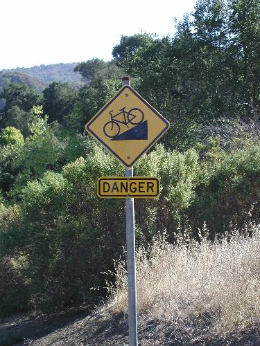
I reached Bear Creek Road and started climbing. The road was very steep, with several extended stretches of 10% grade or more. There was more traffic than I expected. That was not a problem because the speeds were low, but there was little or no shoulder, so I had to regularly check my rear mirror to see how clear I was.
I had not eaten much that morning, so I became pretty hungry. I stopped midway up the climb to eat a clif bar. There was still a lot of elevation gain remaining so I needed the energy.
I was quite exhausted by the time I reached the junction with Summit Road. Here the main climb was finished and the incline was less steep, so I was able to recover my energy. After a couple miles, I turned onto Skyline Boulevard. Again, the incline was relatively gradual to the 3100 foot summit. This stretch of road was virtually abandoned. In the summer, I usually see cars every few minutes, but now I saw only two cars in ten miles.
As the elevation got higher, the winds increased and the temperatures dropped. It was in the mid 40's at home when I left. Bear Creek Road was cold since it is on the shaded side of the hills, but I did not feel it because I was generating a lot of heat as I was climbing. I felt the cold on Skyline since I was not working as hard. Eventually, the clear air became misty, then became a light drizzle.
Then I saw something I totally did not expect — snow. In many places, seeing snow in January is nothing remarkable. But in this area, snow is rare. If it falls at all, it's only at the higher elevations, and that was where I was. But the flakes were very light, and looked like they were half melted already. They melted immediately after hitting the ground.
By the time I reached the summit, it had become very cold. Knowing that I would be going mostly downhill from that point, I put on the rain jacket that I had been carrying. Unfortunately, I had forgotten to pack my ski gloves. The cycling gloves that I was wearing are not wind and water proof, so they do not handle very cold conditions.
Pretty soon, the drizzle increased to a steady, light rain. Fortunately it was not so heavy that visibility was affected. I was now on a stretch of road with more traffic because there were some nearby parks. I soon reached the intersection with Highway 9. I considered stopping at the rest area there to see if the rain would pass, but decided not to. There was no telling how long the rain would last, and I would lose body heat if I just stood around.
I turned on Highway 9 and started the long coast downhill. Because this road is wide and smooth, I usually descend it at 25-30 mph. Now I was keeping my speed under 20 mph. I needed to make sure that I could still stop if I needed to. Bicycle brakes lose effectiveness when they get wet.
The wind was punishing my wet hands and feet. My fingers became numb and then painful. I stopped to see if I could warm them up. But because they were so numb, I could not slip them underneath the elastic of my shorts. I just could not feel what I was doing, and I did not have the dexterity to pull back the elastic. I ended up just blowing on them.
I realized that I had no choice but to accept the pain and continue on. As I reached the middle of the hill, the rain stopped. Near the bottom, the sun started appearing. Now when I reached flatter sections of the road, I pedaled as hard as I could just to build up some body heat.
When I got to the city of Saratoga, I was out of the hills, and could enjoy the sunlight in places. But I never fully warmed up. The sun was low in the sky so trees and building cast long shadows that I had to ride through. By the time I reached home, my body had warmed up again, but my hands and feet were still suffering. I took a 20 minute hot shower, and still there were some slight traces of numbness in my feet.
The end of the ride was certainly miserable, but I thoroughly enjoyed the adventure. I explored routes I had not been on before. I saw snow. I did a 4 and a half hour, 45 mile ride.
Sunday, January 20, 2008
Chilled to the Bone
Saturday, January 19, 2008
Winter Riding
Since my ride from Coalinga, I have only done some short rides. I did not have much to say about them, so I have not written anything for a while. It is not easy to keep an aggressive ride schedule at this time of year for three reasons:
- Daylight is very limited this time of year (7am to 5pm).
- The temperatures are lower. They are not so cold that riding is not possible, rather it is a nuisance because extra planning required.
- We get all our rains this time of year, so the mountain roads can be slick and debris-covered.
On Saturday, I rode up Montebello Road. This was nothing new; I have written about this route a couple times already. What was different was that I did not turn around and ride back down. The road dead-ends at the top, but it continues (inaccessible to cars) as a gravel road for a few miles until it connects to Page Mill Road.
Normally, off-pavement riding is not possible on a road bike, which has very narrow tires. The problem is that the thin, high-pressure tires sink into gravel, get caught in ruts, and cut into soft ground. Mountain bikes have no such problems because their tires are much wider and low-pressure. But I had read that this trail is doable on a road bike, so I thought I would give it a try.
I was also very curious as to where this trail connected to Page Mill Road. I have been on Page Mill dozens of times because it is my standard mid-week ride in the summer. But I was never able to determine where the intersection was on that side.
Riding on the trail turned out to be mostly no problem. There were a couple places where I had to get off and walk. These were mostly steep uphill or steep downhill sections. It was not possible for me to get enough traction to do them safely. There was also one flat section where the gravel was too deep for me to keep the wheels in a straight line.
I discovered why I never saw the intersection with Page Mill Road. The Montebello Road trail stop short of Page Mill, and connects to a private driveway that leads to several private houses. This smooth paved road connects to Page Mill at an electric gate, with several mailboxes next to it. Riding on Page Mill, I always assumed that this was just a housing development. From here, I just descended on Page Mill and uneventfully went home.
Subscribe to:
Posts (Atom)