This weekend was a two-ride weekend. Besides my usual Low-Key Hillclimb yesterday, I had made plans to do a ride with my coworker Michael and his friend Tom.
They were planning on cycling from Livermore, over Mount Hamilton, and to San Jose. Michael's wife was dropping the two of them in Livermore in the morning. Unfortunately, they could only carry two bicycles on the car, and since Vaishali was out of town this weekend, I had no way to do the whole ride with them because I had no way to get dropped off in Livermore.
But I figured out a way to do at least a part (the most interesting part to me) of the ride with them. My plan was to drive up the San Jose side of Mount Hamilton, park at the observatory at the top, ride down the Livermore side of the hill until until I crossed paths with them. At that point I would turn around and pedal back up to the top.
I was happy to have a solution because I have ridden the San Jose side of Mount Hamilton but never the other side. The Livermore side is steeper, which made it irresistible to me.
I woke up Sunday morning with my legs still sore from the Saturday ride. This was a little surprising because I did not think it would have been that much of a strain. It was most likely because after the previous day's ride, I spent the rest of the day with friends and did not get to bed as early as I usually would before another ride. The soreness was not enough to make me seriously consider skipping the ride.
I woke up at 6:00, got ready, and left home at 7:15. There was little traffic on neither the highway nor on the road to Mount Hamilton from the San Jose side. But as I approached the summit, the wind became noticeable. All the vegetation was being blown vigorously, and I even felt the effects driving the car.
When I reached the summit, I parked at the observatory parking lot and walked to the building. I was not able to even walk in a straight line because the wind gusts were pushing me around. There was no way I could seriously consider riding down the other side of the mountain under these conditions. Any crosswinds while descending can make riding downhill tricky, but at these wind speeds it would be dangerous.
At this point I had two options. One was to skip the ride all together. The other was to drive down the other side to the base of the hill, and attempt to ride on just the flat part of the road. Cycling on flat ground is not tremendously interesting to me, especially if it is a two hour one-way drive from home. But there was a possibility that the winds would die down later in the morning, which made me decide that I should try riding.
I drove down the other side of Mount Hamilton. All along the descent, I could tell that it was still windy by how the vegetation was thrashing about. After five miles, the road leveled off and I found a very wide shoulder where I could park. I stepped out of the car and found that there was still some wind here, but much less intense. It seemed rideable, though a little cold.
I started pedaling towards Livermore, and after one mile, I warmed up and no longer felt cold. Although I thought the road would be flat, it rarely was. It winds through several dry creek valleys and over small hills. It is a narrow road with no outlet for miles, so there is usually little traffic. There were many more motorcycles than cars since the winding backroads all over the Bay Area are popular with motorcyclists.
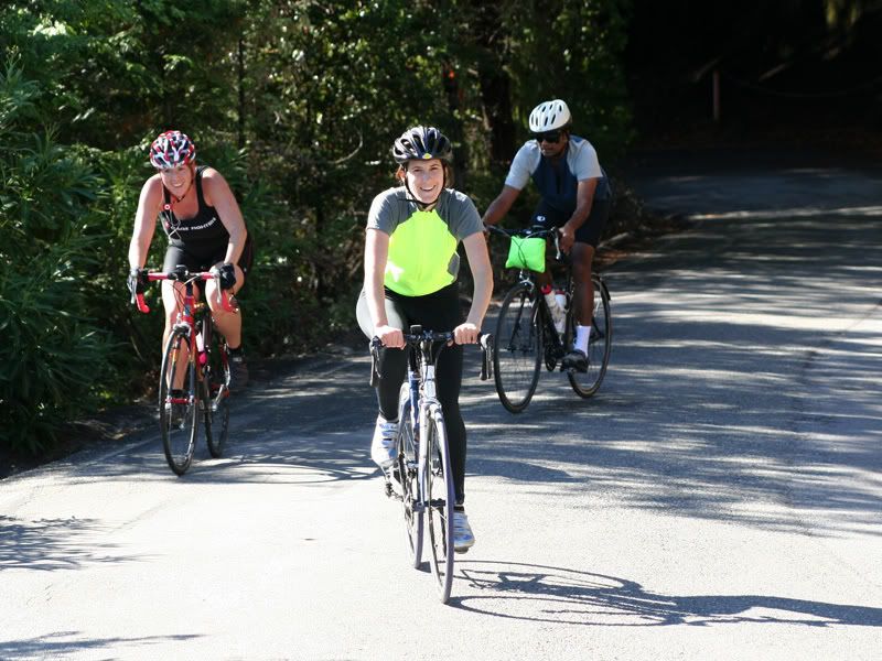
After 18 miles of up and down cycling, with all combinations of headwinds, crosswinds, and tailwinds, I finally crossed paths with Michael and Tom. I turned around and joined them. They had left Livermore mostly when they had planned. Michael reported that the road out of Livermore contained a significant climb.
I explained the situation with the wind at the summit, and how my car was parked at the base of the climb. We made a brief stop at the only junction on the road (at which there conveniently was a cafe). Then we continued to where my car was parked. At this point we all shed our outer layers of clothing since the sun was now higher in the sky and we would be generating a lot of heat on the five mile uphill climb. This was also a good point to have a quick snack.
We started off together, but I fell behind fairly soon. I told the guys to just continue at their pace. If I had any problems, I could just easily coast downhill back to my car. For me, this stretch of road would not normally be particularly steep and difficult. But my legs were noticeably lacking energy this morning, so I could only keep a snail's pace.
I eventually reached the observatory at the summit where Michael and Tom were already getting some snacks from the vending machine and refilling their water bottles. When I first arrived here earlier in the morning, I was the only person. Now there were several cars and motorcycles, and just a few other bicycles here. I had exhausted my two-bottle water supply, so I filled up also.
At this point, we parted ways. They rode down the San Jose side to get picked up by Michael's wife Julie, and I headed down the Livermore side towards my car. It was a short ride back. To get back home, I had to drive back up the summit and down towards San Jose.
I needed to pick up Vaishali at the airport later in the day, so I had just enough time to pick up some food to eat and clean up before doing that. I reached back home at 4:00, so it was a long day of cycling (47 miles) and driving (82 miles). It was satisfying to have done this ride, especially since I had reconsidered it at several points.
Sunday, October 21, 2007
Mt. Hamilton (from the other side)
Saturday, October 20, 2007
Low-Key Hillclimb: Mount Diablo
[official results] [route map] [series description]
This week's race was not as difficult as the last one. We rode to the top of Mount Diablo, which is the second-highest peak in the Bay Area — 3850 feet elevation at the summit.
The only other time I did this route was last year when I participated in an 'official' race, which was the first organized ride I had ever participated in. Back then it was a big deal for me because I was still new to this level of cycling. But this time it was just another ride for me, comparable to many of the rides I have been doing this year.
To avoid clogging the road, we started in several small groups of a dozen or so cyclists. As usual, I lined up in the last group. Everyone dispersed fairly quickly, and most of my passing and being passed happened at the beginning.
At 11 miles, this is longer than most of the other routes in the series. It is necessary to keep an appropriate pace that can be maintained over the whole distance. Although the road is never excessively steep (except at the very end), the grade is enough to be difficult for a beginning cyclist. Fortunately, I have gotten into a shape where I would not have considered this route challenging.
The road to the peak is very scenic, which is fortunate since I was on it for nearly one and a half hours. My hope was that I would post a significantly faster time than what I managed last year. It would be a good measure of how much more fit I am this year.
The finish line at the top is at the end of the only very steep section of the road. Everyone had their picture taken here, and practically all had the same pained facial expression and tight grip on the handlebars. I was no exception.
 photo by Adam Tow
My final time of 1 hour 26 minutes was about 8 minutes faster than last year. This was not as much improvement as I had hoped, but still decent. I may have done better if I had gotten more sleep. I had gone to a party in San Francisco the previous night, so I went to bed at 11:30 then got up at 6:00.
I will be skipping the event for next week because Kannan is visiting us and I want to spend the time with him. Actually that route is mostly flat and I was not particularly interested in it anyhow.
Saturday, October 13, 2007
Low-Key Hillclimb: Bohlman - On Orbit
[official results] [route map] [series description]
This week's ride was amazing. The route was Bohlman - On Orbit. A quick explanation of the name: Bohlman is a 4 mile dead-end road, and On Orbit is another road that branches off Bohlman then rejoins it further. The reason for taking On Orbit instead of staying on Bohlman the whole way is because On Orbit is steeper.
This is considered to be one of the hardest (if not THE hardest) steep bike rides in the Bay Area. I did this route only once, about 6 months ago. And I did it without the On Orbit option. At that time I needed to stop two or three times to catch my breath.
The crowd was smaller as some people skipped this route because it is horribly steep. Knowing that primarily the strong cyclists would be there, and the distinct likelihood that I would need to take some breaks, there was a strong possibility that I would finish last this week.
Another complication was that I knew there would be several slick wet spots on the road. It rained much of the day yesterday. Although today was bright and sunny, the hill soaks up the rainfall like a sponge and it oozes out water for a few days.
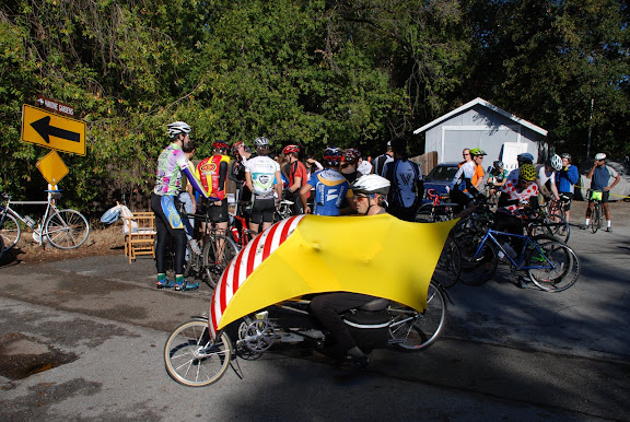 photo by Clark Foy
Because the number of people was smaller, we did a single mass start. Naturally I kept to the back of the pack so that many people would not have to pass me. The road is steep from the beginning. Because of this, the group dispersed into several smaller groups keeping similar speeds (different levels of slow).
I was initially in a group with two other cyclists, both women. I could have gone a little faster than the speed I kept, but I intentionally wanted to preserve strength. Even though this part was steeper than most other roads, the worst part was yet to come.
Having been on most of the route before, I knew when to expect the turns and the short, steep sections. At these points, I made sure to pedal steadily and evenly. These places were usually wet, so sudden strong pedal strokes could cause the wheel to slip. Overall, the road wetness was not causing a problem for me or others.
Just before On Orbit branched off, our subgroup had dwindled to two people as one person fell back. But as we climbed On Orbit, we merged with two others who had been ahead of us.
On Orbit was amazingly steep. It has stretches that sustain a grade over 20%. When it is this steep, it is not possible to ride in a normal biking position -- the front wheel would lift off the ground and you would risk falling over backwards. To prevent this, I needed to lean as far forward as I could. My chin was about one foot from the handlebars. I also slid as far forward on the seat as I could.
It takes a tremendous amount of strength to pedal up a grade this steep, and it did not help that we needed to use so much energy just to get to this part of the route. To mitigate the steepness, all four of us in the subgroup began taking a serpentine route up the road. By zigzagging from the left side of the road to the right, we covered a little more distance, but reduced the effective grade that we were climbing.
We were all traveling about 3.5 miles per hour at this point. This is the slowest speed one can pedal on a bicycle and still keep it upright and stable. It felt like it took a long time. I almost felt like I would run out of energy before I reached the crest of the steep section. I was panting heavily and was becoming dizzy. But I kept pushing and we reached the top. There was a short, steep descent as On Orbit rejoined Bohlman where I could just coast and catch my breath and rebuild some energy.
The road then became a steep uphill that normally would have felt challenging, but which after On Orbit did not feel difficult at all. At this point our four-person subgroup started to spread out, and I was in front. After that section, the difficult climbing was done. The next one third mile was fairly flat. I had recovered enough energy at this point that I felt I could pedal hard and ride fast. I passed a couple more cyclists here.
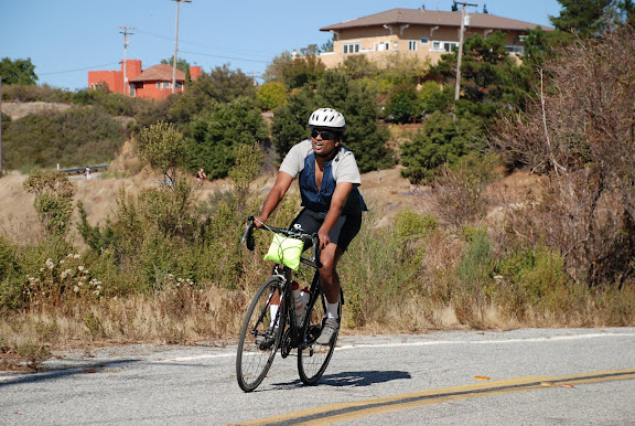 photo by Clark Foy
The rest of the road had some short, steep sections, but nothing too difficult because they were not sustained grades. I kept pedaling hard to the finish. I was fully exhausted, but I was thrilled when I realized that I did the entire route without needing to stop. Clearly I am a stronger cyclist than I was when I tried the road for the first time earlier this year.
I chatted with a couple of people at the finish. I recognized Toby, the guy I chatted with while we were riding on Montebello Road in week one. Somehow I was not as hungry as I usually am after the race, so I only ate a handful of peanut butter filled pretzels.
I was very careful on the ride back down the road. The slick wet spots are more dangerous on the descents. But no one seemed to have any problems with the road conditions.
After reaching the bottom, I called Vaishali. We had planned to meet and do some cycling together. I had to bike uphill again to reach our designated meeting point. During the steepest part of this route, I was suddenly hit by an overwhelming hunger. But I had enough energy to get to the place where Vaishali was waiting. I ate an energy bar (I always keep one with my bicycle just for situations like this) and recovered. We finished our ride, including Vaishali's first attempt to ride up a small hill.
Friday, October 5, 2007
Low-Key Hillclimb: Kings Mountain Road
[official results] [route map] [series description]
This week's ride was up Kings Mountain Road in Woodside. It is one of the easier rides (relatively) on this year's schedule. I have ridden it a couple times, but I have never tried to go up fast.
I decided to take the train to get there, so I had to leave a little earlier than I normally would (because on the weekend, the trains run only once an hour). I rode the train from Sunnyvale to Palo Alto. I brought a peanut butter and jelly sandwich with me to eat on the train. (I wanted to eat something at home before I left, but had NO appetite.) I then rode 6 miles from the station to the staging area in Portola Valley.
I arrived pretty early, so they were still in the process of setting up the registration. But there were a few others there already. I got registered pretty quickly, so I had 45 minutes to spend before we started. I chatted with a few different people and rode my bicycle around the strip mall where we were doing the registration.
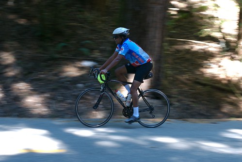 photo by John Gale
Unlike last week where we did a single mass start for everyone, this week we sent out small groups (about a dozen) of riders at a time. They wanted the faster riders to go in the earlier groups, so I waited for the last group.
We left the registration area but had to pedal about three miles to get to the start line. We all did it at a moderate pace. When we reached the start line, we formed a single-file line on a side street. One of the volunteers started the clock and told us to go.
Because it was a small group, all the people dispersed quickly. A couple people passed me, and I passed a couple. At no point did I have a chance to pedal along with anyone.
I think I previously pedaled around 6 miles per hour up this route. Today I tried to maintain 7.5 to 8. Even though this seems negligible, it really wore me out. Because it was all uphill, this small increase in speed required a much larger energy output.
By the time I reached the top (only 4 miles), I was exhausted. I walked around for a minute or two to catch my breath. There was food there, but unfortunately no bananas. I ate a handful of small cookies, a handful of tortilla chips, and a handful of peanut butter filled mini-pretzels. Then I had a half bagel with cream cheese, and really enjoyed that.
The crowd had thinned out by the time I finished. I had seen several people returning down the road during the second half of my ride up. By the time I finished eating, there were not too many people left. I started cooling down, so I decided I should continue my ride before I lost too much body heat.
My plan was to ride back home all the way. The full route (picture below), including the ride from the train station, the race, and the ride home would be almost 60 miles. Specifically, I wanted to go downhill on the OTHER side of the mountain range and then come back up on Alpine Road. I have ridden down this road a couple times before, but have never ridden it up.
 the full route (click for interactive map)
Although I had recovered my energy by the time I reached the next uphill ride, I started dragging about halfway up. But it never got so bad that I needed to stop. I did stop at one point to eat a snack bar. I wanted to go home without eating again, but I started feeling particularly hungry.
I reached the top, crossed over Skyline Blvd and then continued down the other side of the mountain range on Page Mill Road back home. On the way down, I recognized Bay Area bicycling legend Jobst Brandt riding uphill.
I had left home at 8:00am to catch the train, and I returned home just after 3:00pm. Of course, not all of that time was spent riding the bicycle. But it had been a while since I had ridden a route this long, so I really enjoyed it.


