Sunday, November 7, 2010

2010 Two Rock Valley Ford 200KM Brevet

125 miles, 4100 feet elevation, 10:10 total time (8:50 on the bicycle)

The timing was right for me to try another 200KM ride. This was the final event of the year organized by San Francisco Randonneurs.
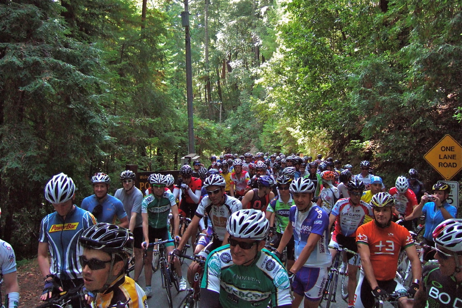
7:00am, 0 miles

It was still dark when we started. There was little motor traffic at this time. After crossing the Golden Gate Bridge and descending into Sausalito, daybreak started and the streets became visible.

The first part of the route is exactly the same as the 115KM Populaire I did a couple months back. The maze of city streets can be confusing with all the turns involved, but I had enough fellow cyclists to follow that I did not need to consult the map. Finally in the town of Fairfax, we started the more rural part of the route, with few intersections and more interesting terrain.

Once we climbed the first small hill, we entered a light fog. The sky was looking threatening, but the forecast said that rain would not hit until the next day. At this point I noticed that my chain was not always staying in the same gear. The shifting mechanism was out of alignment, but I did not want to stop and try to adjust it mid-ride. It was not too bad, and I did not want to risk making the problem worse on an unsupported ride.

On the final hill before the first stop, I had a minor mechanical issue. I tried to shift into my lowest gear, but the chain went off the edge of the sprocket. Fortunately I did not lose my balance as the wheel got stuck while pedaling uphill. I got off, pulled out the chain that had gotten wedged between the large sprocket and the spokes, and I guided it back in place. Each of the riders that passed me as I was stopped asked if I needed help, but I told them that I was fine. I got underway again suffering only from greasy fingertips. But I was careful for the rest of the ride to go no lower than my second-lowest gear.

10:05am, 43 miles

Our first stop was in the town of Petaluma and we had the choice of stopping at either a convenience store or a coffee shop. I thought I would have a better selection of high-calorie junk food at the convenience store. I did manage to get a satisfying donut (danish), but the store had no restroom. It was not urgent for me to use one, but it was a good idea to go at this time. After eating I continued on to the coffee shop and used the restroom there. This allowed me to also wash all the grease from my fingers.

The next part of the route was an almost straight west leg towards the coast through the Two Rock Valley. This part contained rolling hills and a steady headwind. Fortunately, the wind was lighter than usual so it did not make the ride too difficult.

Here, I again came close to crashing. As I approached a medium sized tree, I did not see that it had one dead branch that stuck out at face-level over the edge of the road where I was riding. The rest of the tree was green and leafy, but the dead branch was bare and brown like the hills in the background. Because it was camouflaged, I did not see it until the last second. I was startled as it appeared suddenly in my face. I reflexively swerved to avoid it, but the sudden turn made me feel like I was about to topple. I corrected, then re-corrected, and finally regained control and managed to stay upright. Fortunately the rest of the ride had no more thrills like this.

11:45am, 61 miles

The next stop was at the small hamlet of Valley Ford, which is on Highway 1. This was another convenience store. I was not hungry, but knew I needed to consume more calories. I thought it best to get something easy to digest, so I bought a small box of butter crackers and a soft drink. I could not eat all of the crackers so I took what I could not consume with me. They would be a good emergency snack if I ran low on energy.

Now the route turned south, and the wind was mostly at our back. The rolling hills continued as we followed the edge of Tomales Bay. Here the sky had thick clouds which blocked out a good amount of the sunlight. It felt like later in the evening, but a glance at my watch confirmed that it was still only early afternoon.

1:50pm, 84 miles

The final stop was in the town of Point Reyes Station. Although it is a small town, it is at the crossroads of several tourist destinations so it has a good amount of services and visitors. We could visit any establishment here, so I chose a market where I could get a vegetable sandwich and a soft drink. After eating simple carbohydrates thus far, I thought it would be a good idea to now eat something more balanced. Unfortunately, the eggplant in the sandwich was tough and fibrous. I thought it might disagree with my stomach, but I had no problems for the rest of the ride.

The next part of the route closes a loop before retracing much of the morning route. I usually see many other recreational cyclists in this area, but the threatening clouds seemed to have kept most of them away.

By the time I reached back to the city of Fairfax, the scenic part of the route was over and it was city streets again until the end. I needed to use my GPS unit to navigate through the maze since my fellow riders had spread out by this time.

As we approached San Fransisco again, the skies were clear and the sunshine was bright, so here there were many more recreational cyclists than near the coast.

5:10pm, 125 miles

The finish was at the same place we started, but I could see everything clearly in the daylight. I kept a good pace and kept close to the same time as my last brevet, which was the same distance but with less elevation. However, about two thirds of the 70 riders finished earlier than I did.

I packed up the bicycle and started what should have been the 50 minute drive home. However, I got caught in a traffic jam trying to get out of San Francisco. So, it ended up taking an hour and a half to get home. Surprisingly, my butt got more sore sitting in traffic than during the bicycle ride.

This will most likely be the final organized bicycle event of the calendar year. It is not too cold for events, but with the rains starting and short daylight hours, clubs do not bother to schedule anything now. I hope to find some time to ride on my own and keep in shape.

Sunday, October 31, 2010

Next Race

[official results] [route map] [series description]

This week's entry in the Low Key Hillclimb Series was a hill that I had never ridden before. The road is East Dunne Ave near the town of Morgan Hill. It is about 35 miles from home and in an area that I rarely ride in. The forecast called for rain that day, so there was a good chance that the ride would be canceled.

It was dry when I left home, but 40 minutes later when I arrived at the registration, there was a light drizzle. Normally I would have skipped the risk of riding a slick hillside, but I had already invested in a long drive to get there. Plus, the allure of a new climb was too tempting.

We had a five mile ride to the actual start location. When the time came to start, the rain had stopped and blue sky was starting to appear on the horizon. This made all the riders happy. Because the road is narrow and we had close to 100 riders, everyone was started in batches of around 2o. People self-organized with the faster riders going first. I started with the fifth (the last) group.

Because the group was dispersed by the staggered start, there was less bunching that what happened last week. Still I passed a couple riders early while a few passed me.

The grade was fairly consistent and never exceptionally steep, but I felt I was not keeping as strong a pace as I normally would. I am guessing that the cool wet weather affected me, since I tend to thrive better than most in the heat.

The promise of clearing that we saw at the start disappeared as we rose in elevation. Pretty quickly, we entered thick mist. There was intermittent rain until the end. There was a downhill stretch in the middle of the climb, but I had to limit my speed there. My brakes were wet and had lost much of their effectiveness. I had to keep a speed at which I could still come to a stop if needed.

I passed one rider and stayed ahead of her for a while, but she passed me on the downhill section and stayed ahead until the finish. A half mile from the finish, a cyclist I passed just after the start passed me again. There was one last steep climb before the finish and I passed him there. But I used all my energy and he passed me again 20 yards from the end. We both put all our remaining strength into a sprint finish. But unlike last week, I did not have enough to win the sprint.

Photo by Thomas Preisler.

My final position was similar at 84 out of 86 men, and 94 out of 98 overall. Those numbers sound weak in print, but it was a fun, challenging ride. It was a slow, wet, cold descent back to the car. The long, hot shower at home was heavenly.

Sunday, October 17, 2010

Low Key Again

[official results] [route map] [series description]

It has been two years since the last time I rode in the Low-Key Hillclimb series. These are the informal races done each fall, on some of the steepest Bay Area hills. I could not attend the first two of the series this year. Since they were roads I ride often, I did not miss much. The third one was a new route for me — Portola Redwoods State Park.

The road to the park is a small, remote, dead-end road. After registration at the summit (where Vaishali dropped me), all the riders descended down to the park entrance. Having a few minutes until the start, I rode further down the road into the park and back uphill to warm up my legs.

A mass of 116 cyclists lined up in a pack at the start. Fortunately not many cars came by needing to go through, because the road was fully blocked for a few minutes. The group lurched forward slowly upon "go" since the road was moderately steep right from the beginning. A couple riders had to stop because they were in too high a gear to pedal uphill. One stopped right in front of me. It was difficult to maneuver at slow speed to get around him with other cyclists just inches away from me, but I managed to keep pedaling and get past.

The mass of riders at the starting line. You cannot see me because I am too far in the back. Photo by Bill Bushnell.

The pack soon stretched out to a more narrow queue. From the beginning, I kept a strong pace (for me). I intentionally started at the back of the pack since I knew most of the riders are much stronger than I. Still, several people behind me passed me, but I was also passing a few.

The road never flattened, but fluctuated between moderately steep, steep, and significantly steep. I wondered whether I was keeping a sustainable pace because I was pedaling faster than I normally would on a road this hilly. My final average speed of 7.7 miles per hour probably does not sound too difficult, but considering the terrain, it surprised me to go that fast.

Around the halfway point of the 5 mile course, the pack positions stopped changing much. I had been pacing myself behind another rider for the past mile, but I felt I could pass him and sustain a slightly faster speed. By now we had left road to the park and we were on West Alpine Rode, which I had ridden several times was familiar with.

I did not rest on the flatter sections in order to keep up my pace.
Photo by Judy Colwell.


At a relatively flat section, I was quickly passed by another rider. However, the road pitched up again and I was able to close the distance between us. It felt like he was keeping a pace I could sustain. At a couple points, I thought I had the energy to pass him, but I decided against that because I did not know if I would be able to remain in front of him. I decided I would stay back until closer to the finish. It is nice knowing the road because I knew roughly how far away the finish was and generally which parts are steeper and flatter before reaching them.

As we neared the end, I breathed deep and readied myself for a final surge. When I saw that the finish was 20 yards away, I pedaled with all my energy. I picked up enough power that I shifted into a higher gear and zoomed past the rider that I had been following for the last mile. I actually gained enough speed that I sped past another rider further ahead of him just before crossing the finish line.

I shouted out my number with what little breath I still had so they could record my time. I was panting mightily as I continued on past the finish. Having used all my energy in my final surge, I was hit with a sudden wave of nausea. I pulled over in a shady spot by the side of the road and stood over my bicycle to catch my breath. The rider who I had been tailing rode passed and shouted "Great finish!" I only had energy to smile and weakly wave back.

After just a couple minutes I recovered enough to continue further down the road to where there were snacks and water. I did not feel like eating anything, so I just nibbled on a couple crackers and filled my water bottle. My energy came back quickly and I set off for my ride home. I went down the other side of the hill that we raced up and covered a few flat miles to home.

When the results were posted the next day, I discovered that with all my efforts, I finished 97th out of 110 men (and 100 out of 116 including the women). I would have finished two slots further back without my sprint finish. Although this sounds decidedly unimpressive, it must be noted that I am a novice among veterans here. Many of the riders are former and current amateur racers. And most of them have many more years of cycling experience than I do.

I should be able to do a few more rides in the series this year.

Tuesday, October 12, 2010

2010 Winters 200KM Brevet

126 miles, 3100 feet total elevation, 10:10 total time (8:27 on the bicycle)

I had a chance to do another brevet this past weekend. It was organized by San Francisco Randonneurs, who also held the one I did three months ago. Most of the route was new to me, which was the main draw. The ride started in the town of Hercules and immediately crossed the Carquinez Bridge. It then continued on back roads to the town of Winters before looping back and returning to Hercules.

7:00am, 0 miles, 0 feet total

I left home at 5:30am and arrived at the start at 6:40, giving me just enough time to set up and register. After checking in, I proceeded to get my bicycle ready. I discovered that the box I packed with some of my gear was left at home. I needed to quickly assess if I was missing anything crucial that would require me to abandon the ride.

I had my helmet and prescription goggles. I had my shoes. I was already wearing my cycling clothes, so that was not a problem. I did not have my GPS unit. However, I had studied the route closely and I could simply navigate with the paper map (the organizers had extra copies) and my odometer. I definitely needed to carry water and I did not have my water bottles. One of the organizers had one on hand that he gave me. I filled it with the water I had in the car for the drive. I was missing my headlight, but we were starting after sunrise, and my normal pace should get me done before sunset. I did not have my gloves or ear covers. It was a chilly morning, but I could deal with the cold until the day warmed. My ride would not be unsafe without any of the items I forgot, so I was comfortable doing the ride. The whole group started at 7:00am.


The route started at the southernmost point, followed the loop counter-clockwise, and returned.

8:40am, 24 miles, 300 feet total

The first stop was at a store in Fairfield. Here I bought some bottled water, and made my selection based on which bottle would best be carried on my bicycle and could be refilled. Now I was back to carrying two water bottles and did not have to fear the heat. Through this part of the route, many of the cyclists were bunched together. There was very long line at the checkout. I was buying a small cake for a snack. Since I was just waiting in line, I ate the cake and by the time I reached the clerk, she just scanned the empty bag.

After this stop the cyclists became more spread out. I chatted with a couple other cyclists when we were keeping the same pace for a while. As we neared the next stop, we missed a turn because we were talking to each other. We reached an intersection that did not correspond to the route directions, and so realized we had missed a turn. We backtracked and found the correct branch to take. It was just a two mile diversion.

11:00am, 59 miles, 1000 feet total

Although brevets are unsupported rides, this one unusually had a staffed lunch stop where food was provided. Since this ride is one of the last in the group's calendar year, they do it as more of a social event, and so provide lunch. It was the halfway point distance-wise, but none of the significant climbing had yet started.

The next stretch of the route was the most scenic. It was the middle of the day and hot in the direct sun. There were a couple big hills. The climbs were relatively long, but not as steep as what I usually train on. I had no problem keeping a strong pace.

1:30pm, 80 miles, 2900 feet total

The next stop was convenience store in the middle of nowhere. I only took a short break here and continued. I almost missed a turn again at a junction without road signs. There was a crew of firemen on the side of the road and they were able to confirm for me that the road I needed to take was indeed the one at the junction. The riders were all spread out at this point so I was seeing few of my fellow cyclists by this point.

The remainder of the loop was flat again and not particularly interesting. This section was through Napa Valley, and consisted of vineyard after vineyard. Eventually the route returned to the convenience store which was also the first stop. The loop part of the route was finished. Since it was near a highway, I was able to call Vaishali and update her about my status. I did not have phone reception earlier because the roads were so remote.

3:30pm, 100 miles, 3000 feet total

There was only one other cyclist at the store when I arrived, but several came in while I was there. One of the guys I was riding with earlier suggested we ride together, so I waited an extra five minutes for him. The remainder of the route was the same as the morning. I returned back the the start at the time I expected to.

5:10pm, 126 miles, 3100 feet total

This group is holding their final ride of the year next month. It is also a 200KM brevet, and I will probably attempt that one too.

Sunday, August 1, 2010

2010 Santa Cruz Mountains Challenge

100 miles, 10225 feet total elevation,
9:45 total time (8:30 on the bicycle)

I did this century three years ago, and I have wanted to do it again ever since. I was barely able to finish that time due to exhaustion. I wanted to redo it and finish strong, but each year I had a schedule conflict. This year my weekend was free, but I did not think I had the necessary training.

This is probably the hardest 100 mile ride that I have ever done, due to the total elevation and the steepness of the hills. The Death Ride is comparable since it has a similar ratio of elevation to miles. The Death Ride is 40% longer, but the Santa Cruz Mountains Challenge has steeper hills.

In spite of my lack of training, I decided to give this ride a try. I have a good familiarity with the roads in the area, and there are options for cutting the ride short if needed. I knew it would be difficult, but my goal was simply to finish without too much struggle.

6:45am, 0 miles, 0 feet total

I woke up at 4:45am and left home by 5:45am. I made the 45 minute drive to Scotts Valley, the start of the ride, which is near Santa Cruz. It took extra time to get registered because they did not have my name on the list of riders. Because I registered online and paid with Vaishali's PayPal account, they had her name on the list instead of mine. Once that confusion was cleared, I started.


The route was counter-clockwise, starting and ending in Scotts Valley.

It was distinctly cold at the beginning. Scotts Valley was shrouded in a thick blanket of fog, and the early morning sun was not heating up anything. Although my teeth were chattering, I was happy to experience this. One of the main reasons for my struggles three years ago was the heat. We have been having a cold summer this year and today was typical. A cool day meant it was less likely for me to overheat on the climbs. As soon as I started uphill on Mountain Charlie Road, the first major climb, I warmed up. By the time I reached the summit, we were above the fog layer and the bright sun was warm. (Usually the mountaintop is colder than the valley, but not today.)

There was a water stop at the summit, but I had no need to break there. I immediately began the descent to the town of Boulder Creek, and back to the chill. I did not rest long because I did not want to cool down too much. I made sure to eat some high calorie food (cookie, bagel, banana bread) in preparation for the two steep hills coming up.

8:20am, 21 miles, 2225 feet total

After a couple relatively flat miles, I reached the second major climb of the route -- China Grade Road. Although it is exceptionally steep, it is mercifully short (relatively). The steep portion is only 1.25 miles. I knew I would have little problem with it. My goal was to not push myself too hard and use up too much energy. Several cyclists passed me but I found myself behind one who was going between 3.5 and 4 miles per hour. I was averaging slightly more, and I had an urge to pass him, but I decided to let him pace me and preserve some strength. I reached the summit and immediately continued downhill. This was a mini-loop which took me back to the base of China Grade, and to the next rest stop.

9:50am, 34 miles, 4100 feet total


Again I minimized my rest time and made sure to eat. Now I was to tackle what I expected to be my biggest challenge of the day -- Jamison Creek Road. Last time I did this ride, I could not make it to the top without having to stop. This road is ridiculously steep. The grade is comparable to China Grade, but it is nearly three times as long. My previous effort was hampered by the high temperatures, which totally drained me. This time it was much cooler. To my surprise, I kept a steady pace and was not wiped out when I reached the top. The ride organizers measured everyone on this stretch, and my time was 319 out of 470 riders. Although this is not an impressive percentile, it is better than I thought possible. I was in good spirits when I arrived at the lunch stop.

Reaching the top of Jamison Creek Road.

11:00am, 43 miles, 6000 feet total


I decided to rest here more than I had at the earlier stops. I ate slowly and chatted with some other riders. It was nice knowing that most of the elevation has been done and the two steepest roads were past. I headed out 3o minutes after I arrived. The next portion was a long descent to the Pacific coast. This essentially was continued rest time since I did not have to expend much energy.

After reaching the coast, we headed north along Highway 1 and then turned around. This involved some smaller climbs, and I could tell that my legs were not as fresh as earlier. I pulled into the last rest area. Even though I wanted to eat to fuel up, I had no appetite. The only thing I could manage to consume was a can of soda.

1:15pm, 66 miles, 7125 feet total

We then headed back from the coast on the fourth big climb of the day - Bonny Doon Road. It was my first time on this road, and I had wanted to try it for a long time. For the past two years, this climb was part of the Tour of California (professional bicycle race) route. I did not realize how difficult it was. The three miles of consistent 9% grade was not as steep as China Grade or Jamison Creek, but having used up most of my energy on the previous climbs, this one was hard for me.

Actually my core energy was fine. I did not feel weak or dizzy. The problem was that my leg muscles were fully used up and I could not push myself beyond a slow crawl. I simply kept it in low gear and accepted the slow pace. I could tell that I would have no problem finishing, but that any remaining hills (even the small ones) would slow me down. After this climb, we again headed back to the coast, this time into the town of Santa Cruz. Now my energy level did finally crash. But because I was in the city, it was not an issue. I stopped at a corner store and bought a chocolate bar. I felt the effect almost immediately, and I knew the final moderate hill to the finish would be no problem.

4:30pm, 100 miles, 10225 feet total


I reached the end with great satisfaction. The last time I did it, I was dazed and energy-less. This time I felt good. I ate the dinner provided and then headed home. I usually recover quickly, but the next day my legs were much more sore than usual. I expected this since I really shredded my leg muscles. It was a great feeling of satisfaction knowing that I am still capable of riding strong.

This could be my last century of the year. The remaining ones on the calendar are either too far out of town, or are familiar nearby routes that are not interesting or not challenging enough. Still, there are a couple that I could possibly work into my schedule. I will definitely try some more long rides with friends.

Monday, July 19, 2010

Point Reyes Populaire

115 KM (73 miles), 4250 feet elevation gain
5:30 hours total (4:45 on the bicycle)

My latest cycling event was enjoyable and a success. This was the second brevet that I have ever done (the first being the Chualar 200KM which I did two years ago). It is called a "Populaire" because it is less than the usual minimum 200KM for a brevet. It started in San Francisco, and the "Point Reyes" refers the furthest point on the route which is the town of Point Reyes Station.

Vaishali, Aasha, and I left home at 5:15am. I ate breakfast in the car while Vaishali drove. The starting point was at the visitors area at the south end of the Golden Gate Bridge. We reached there by 6:15am (including a stop for coffee for Vaishali). This gave me plenty of time to get my bicycle ready and get checked in. I chatted briefly with a couple people before the start, including Michele Santilhano, who recently complete the Race Across America. The whole group of around 150 riders started at 7:00am by crossing the Golden Gate Bridge.

It was distinctly cold at the beginning, but I did not want to put on my jacket because I knew the day would soon warm as the sun rose and as we left the fog of San Francisco. Plus I knew that I would build up enough heat with my pedaling. Knowing that this was not a particularly long distance and that the total elevation would be less than many of my training rides, I planned to keep a fast pace for the whole day. In addition, Vaishali had other plans for later in the day, so I needed to finish on time.


The route started in San Francisco and headed northwest through Marin County. The loop was ridden clockwise, and we retraced the route back to San Francisco and back across the Golden Gate Bridge.

The first 15 miles of the route passed through many city streets. After that, there were no more issues of coexisting with motor traffic, watching for turns and intersections, and dealing with stop signs and lights. I was determined to keep a relatively fast pace of 20 miles (32 kilometers) per hour on the flat parts of the route. Many other riders were keeping the same pace, and several passed me, going even faster.

I made no stops until we reached the halfway point, which was about 35 miles from the start. We had a designated stop in the town of Point Reyes Station, which I reached 9:15am. I got a sandwich and soft drink at a store, and chatted with other riders as I ate lunch and rested a little. After a bathroom break, I headed back at 9:45am. This next part of the route is very popular with cyclists in general, and I was seeing many others now. The day had warmed considerably, but was thankfully not particularly hot. There was one more designated stop, which I reached by 10:30am. I only needed a brief bathroom break, and I knew that I would not need to stop again before the finish.

Although I do not bicycle in Marin County that often, I realized I was familiar with much of the route. Most of the scenic part overlapped with the Mt Tam Double Century which I did two years ago. Other parts, I had driven on at different times.

I stopped briefly at 11:30am to call Vaishali to let her know that I was about one hour from the finish. I reached the end at 12:30pm. My fast pace meant that we had plenty of time for our other plans. Although the route was less challenging than usual in terms of hills, my race against the clock made it interesting.

Wednesday, June 23, 2010

2010 Best of the Bay Century

104 miles traveled, 8000 feet total elevation gain, 8:40 hours total (8:00 on the bicycle)

Finally I can write a ride report without complaints. I had enough time to prepare for this ride, and I was fully healthy. The Best of the Bay Century is a ride I have not done before. It falls on an open time in my calendar, so I decided I should try it. Unlike my other centuries, this one is not a complete loop — it starts in one city and ends in another city 35 miles away. So the entry fee includes a train ticket from one city to the other.

I woke up at 4:00am, got ready, and ate some breakfast. I left home at 5:00am and drove 30 minutes to the terminus in Fremont. I met the staffer there who checked me in and gave me the one-way train ticket to the start in Orinda. After a short wait, I and about 10 other participants boarded the first train of the day. It was a 45 minute ride, which included one transfer in Oakland.

About 90% of the riders arrive in Orinda, ride the course to Fremont, then take the train back in the afternoon. These participants have the benefit of starting earlier. I was constrained because there was no earlier train than the one I took.

7:00am , 0 miles, 0 feet

There are several course options because there is a short loop at the beginning and another short loop at the end. Rider can choose to do both, skip one, or skip both. My goal was to do the first loop and probably (depending on time and strength) skip the second one. It seems most riders skipped the first loop. The second is the more interesting one because it includes a steep hill. Doing the route with just one loop still covers 100 miles. I definitely wanted to do the first loop because that part was all new for me.


The start is near the loop at the top, and the finish is the endpoint near the bottom.


There were only a few riders on the first loop, and I chatted briefly with one as we rode together for a few minutes. I asked some questions about the route, since he had done it before. I finished the loop without seeing too many other riders. I continued on the route and the steeper climbs of the Berkeley hills started.

I was surprised that I had not yet reached the first rest stop. Eventually, I sensed that something was off with the route so I stopped and examined the map closely. That is when I discovered that I had missed a turn near the end of the loop. This meant that I had cut a few miles from the route, and that I had missed the first rest stop.

Although I was a little hungry, the main reason I needed the first rest stop was for the bathroom break. Fortunately where I stopped was at a park entrance with a public restroom. I deemed this my unofficial first rest stop. I decided that I could wait for food until the second official rest stop. Fortunately I had eaten food at home before starting so that was sustaining me (plus I was carrying an emergency snack with me in case I could not last that long).

9:25am, 21 miles, 3200 feet

This part of the route was the ascent of the east side of the Berkeley hills. Here there was an option of taking a "shortcut" on a short road called South Park Drive. Although this option trims a couple miles from the route, it actually makes it harder because losing those miles of distance means it is much steeper in covering the same elevation. As I rode along I finally saw the sign for the road and decided to take it. I was puzzled because the road started downhill. I thought this was weird, but I guessed it may start downhill then suddenly turn into a steep uphill. But the road became an even steeper downhill. Then I realized that I was backtracking! I had somehow missed the road at the bottom, so I took it from the top and headed back downhill. By this time I was more than halfway to the bottom, so I decided to go all the way so I could where I missed it. I then turned around and headed back uphill. This time my route mistake resulted in adding a couple miles, so it mostly compensated for my first mistake, distance-wise.

Shortly after, I reached the summit of this part of the route. Normally there is a fantastic view of San Francisco including both the Bay Bridge and the Golden Gate Bridge. But at this time in the morning there was enough fog that the Golden Gate was barely visible. The route then plunged downhill into a undeveloped valley (via Pinehurst Road) where I reached the second rest stop.

10:45am, 40 miles, 3700 feet

The staffers here confirmed that the majority of riders had already passed through, because they had started earlier or skipped the first loop, or both. After some food and a bathroom break, I continued on. Although the whole morning had been colder than usual, I really felt the chill now. The valley was holding the cold air, the thick tree cover blocked out the sky, my 10 minutes off the bike made me lose some body heat, and the road pointed downhill for a couple miles (meaning I did not have the option of hard pedaling to warm me up). At this point I was noticeably shivering and my teeth were chattering. I was happy to see the road turn back uphill after a couple miles.

The road continued through an undeveloped valley (via Redwood Road) that felt more like the remote Sierra Nevada foothills than the edge of a major metropolitan center. Eventually the route led into the city of Castro Valley and the third rest stop.

11:45am, 58 miles, 5200 feet

Again, the route left the city and followed a valley on the undeveloped side of a mountain ridge (via Palomares Road). For the first time today, I no longer felt cold as sky fully cleared and the day's warmth finally built up. After not seeing many of my fellow riders for a long time, I managed to pass a couple. The miles and the hills were adding up and slowing me down, but I still had plenty of reserves. As I pulled into the lunch rest stop, I finished the part of the route that was new to me.

12:50pm, 72 miles, 6200 feet

The rest of the course was all on familiar roads, mainly Calaveras Road. As I passed the Calaveras Reservoir, I noticed the high water level that was the result of an extended, rainy winter this year. There were quite a few other cyclists on this stretch of road, most of whom were not part of this century ride. The uphill sections on this stretch were not steep, but they were taking their toll and draining me. I eventually made it to the final rest stop.

2:20pm, 89 miles, 7100 miles

Now I had to decide whether to do the final loop. I felt like I had enough energy left in reserve to do the steep slope of Sierra Road at a slow pace. But considering that I had done it many times before, I decided to save the hour and a half by skipping it. I could get a few things done at home with the extra time. The final part of the route was mostly flat and a mostly uninteresting roll through the town of Fremont.

3:35pm, 104 miles, 8000 feet

The ride ended at a buffet restaurant (Sweet Tomatoes) where the dinner was included with our ride. I indulged in the food and chatted with some other riders. The train station was only one mile from the restaurant, so I was able to quickly get there, pick up the car, and leave for home.

I was glad to have the chance to ride on some new roads. I am sure I will be doing a couple more centuries this season, but I have not decided exactly which ones. There are a couple challenging ones that I want to do, but I will need to improve my conditioning. We will see if I am able to do that.

Monday, June 7, 2010

Sequoia Century 2010

112 miles traveled, 9200 feet total elevation gain, 10:20 hours total (9:10 on the bicycle)

I was finally able to do my first century of the year. I expected to have done at least one other century by now (in my last report, I mentioned the Mt Hamilton Challenge). But a combination of schedule conflicts, seasonal illness, and not enough preparation eliminated several centuries that I was interested in.

The Sequoia Century is not really an ideal "first" century after a layoff. The course changes regularly, but always contains several climbs, some of them fairly steep. The total elevation is usually around 9000 feet, which is more than most hilly centuries. But it fit into my schedule, so I decided I should just do it instead of waiting for another and risking not being free or in shape.


The route started near "Stanford" and was ridden clockwise.


Another draw for this one is that I would be able to ride with my friend Gabrielle. She is the rider who crashed at the railroad tracks the first time I rode the Sequoia Century three years ago. We coincidentally met again a few months ago during the King Ridge Gran Fondo. After that we got in touch with each other. We tried to do a training ride together, but could never find common times in our schedules (mostly my unavailability). This was a great opportunity to meet again.

Not surprisingly, this one almost got skipped like the others. Four days before the ride, I came down with a cold and a slight fever. I rested as much as possible to allow myself to get back to full health. My illness lingered on with a nasty cough, nasal congestion, and a slight fever. I would have to assess my health on the morning of the ride and make the decision to do it or not.

5:05am, 0 miles, 0 feet

I woke up at 4:00am, and started getting ready. I had no fever, but still had the cough. I decided to try to do as much of the route as possible. The organizers have several support vehicles patrolling the route, so if I had any trouble, I could easily flag one down and abandon the ride.

Gabrielle and I had decided to start the ride at 6:00am. I left home at 5:05am so that I could slowly ride the 9 miles from home to the official start and have enough time to rendezvous. I could have asked Vaishali to drop me and have left home a little later, but I did not want her to get out of bed early to do that.

The sun came out during this short stretch, and I was coughing and coughing most of the time. I spit out so much phlegm which meant I was either too sick to ride, or that I was getting my respiratory system cleared enough to enable the rest of the ride. I was hoping for the latter.

6:15am, 9 miles, 100 feet

After meeting with Gabrielle and her friend Denise, we got underway. This section of the route to the first rest stop starts flat and ends with the first big climb of they day. It also contained the steepest road of the day — the short but difficult Redwood Gulch Road. This was actually fortuitous for me, since it gave me a gauge of my fitness level right at the beginning.

I knew right away that I was not at 100%. I usually feel highly energized at the start of the big ride, due to adrenaline and high food intake, but this day I was feeling slightly sluggish. We all kept a moderate pace approaching the climb. On the climb, I kept a very slow pace (just above 4 mph). It was hard but I finished the steep section without serious problems. On the shallower climb to the summit, I felt drained and was being passed by rider after rider. I finished the steep part just behind Gabrielle, but she had been waiting at the rest stop for a few minutes.

8:10am, 27 miles, 2730 feet

After resting and eating, I recovered much of my energy, and it looked like my fever was not returning. At this decision point, I decided that I should continue. I had gone from feeling that I had a 50% chance of finishing to now a 75% chance. I felt surprisingly strong on the next section of downhills and uphills. A long downhill section gave me more opportunity to rest, in addition to the rest stop at the bottom.

10:00am, 50 miles, 3750 feet

Since my energy level seemed normal, I did not linger too long at the rest stop after eating and a short rest. The next section was a long, but not too steep climb. Here again, I was feeling sluggish. Upon reaching the summit, the course had a sequence of rolling uphills and downhills. Here, again, I felt stronger than expected. Now I was realizing that I had strength to handle short uphill bursts, but not the energy to sustain a long climb well.

Fortunately, with two long climbs already done, we had covered 2/3 of total elevation gain. There was one more significant climb left, but there was a long descent before it, plus the third rest stop (the lunch stop). Surprisingly, after the long descent down towards lunch, I lost some energy. I struggled a little the final few flat miles to the stop. I guessed I needed food and rest.

12:50pm, 77 miles, 6430 feet

Here there was another decision to be made. I was feeling strong enough to do the 100 mile route, but Gabrielle and Denise were originally planning to do the 200 km route. The two routes were the same until this point, but diverge (with the 200k adding an extra loop) after the rest stop, hence the decision. Although I felt it was possible to do the extra 24 miles (and 1000 feet elevation), I though it unnecessary, considering my state. I thought it would be wiser to just stick to 100 miles. Denise had some leg problems which made her also cut back to 100 miles, and Gabrielle chose to just join us on that route.

After eating, I rested a little extra time (25 minutes total at this stop). Gabrielle and Denise left just before I did. I would not see them again until the finish. Even with the extra rest, I felt sluggish after leaving. I basically plodded along at slow pace. There was one rest stop at the base of the next climb, so I just wanted to make it there and get some more rest.

2:15pm, 88 miles, 7010 feet

I barely ate at this stop, but I rested. Again, I stopped for 25 minutes, 10 minutes of which was a short nap at a picnic table. I decided not to stay longer and risk cooling off and stiffening, so I pushed on. Still the energy had not returned as I approached the climb — Tunitas Creek Road — which is several miles and moderately steep. Although my energy level was low, it was not zero. I was able to just keep going.

Somehow in the middle of the climb, I started recharging. As the energy came back, I was able to increase my pace. I started passing several of the riders who passed me at the bottom. They were losing energy as they climbed (which is typical for a steep hill), but somehow I was gaining. There was a small drinks stop at the summit, which I just rode past. It was all downhill or flat from here, and I was feeling good.

4:15pm, 112 miles, 9200 feet

I stopped 10 miles from the finish to call Vaishali. I told her I would be done in 30 minutes and she could meet me then. I kept a strong pace and finished well. Gabrielle and Denise were still resting at the finish so I chatted with them before they left. There was a lot of food there which I indulged in while waiting for Vaishali to arrive. She brought Aasha with her, and Aasha enjoyed a cracker, a cookie, and some nibbles of pasta with me.

I felt good returning home, but had very little energy the rest of the evening. This ride was a test of my fitness level, and I passed it. I was originally concerned about my fitness level, but doing this while still ill meant that I was much stronger than I expected. Now I feel comfortable trying a couple more centuries this year.

Thursday, March 4, 2010

Long Layoff

It has been a long time since I was able to do a serious bike ride. I have only been on the roads once in 2010, and that was a short ride.

This is due to a combination of a month-long vacation out of the country, seasonal illness, a baby to care for, and the regular winter rains. One or more of these factors have made weekend riding impossible.

This has actually served as an experiment in conditioning. I had tapered down my riding at the end of last year, and did no riding in January of this year. When I tried riding my bicycle trainer in my garage in mid-February, I noticed the difference. I was struggling to keep up while keeping a pace lower than what I usually do.

Since then, I have ridden the trainer three more times and rode my usual short training route on a sunny weekend. Now I feel myself recovering my fitness level. Winter will be over soon enough, and I need to set some goals for this year.

I had entertained thoughts of attempting a double century again. I did not do one in 2009. However, I am starting at a lower fitness level and I know I will still have limited time to train. It is clear that I am unlikely to be able to get myself strong enough to do a double century.

Centuries should still be within my grasp. On any single day in 2009, my fitness level was such that I could have ridden a century with minimal preparation. I am not at that level now. If I can find just a little time to ride on weekends, with occasional long rides, I should get strong enough to do several centuries in 2010.

I received a flyer in the mail notifying me that this year's Mt. Hamilton Challenge is April 24. It is probably my favorite century, and I have done it each of the past two years. I really want to do it again. It is about one and a half months away, so it will be a challenge to get into shape for it. I probably will not reigister for it until I improve my conditioning over the next few weeks.